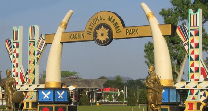
Myitkyina

Myitkyina Location
Covering an area of 34,379 sq miles and with a population of over 1.2 million, Myitkyina is in the northernmost state in the Union of Myanmar. As its name (Myitkyi means “big river” and na means “near”), Myitkyina is on the western bank of the Ayeyarwaddy River.
How to get there
Total flying time: 185 mins from Yangon to Myitkyina. By Malikha–Mandalar Train from Mandalay to Myitkyina—it takes 25 hrs passing through towns such as Shwebo, Indaw, Mohnyin and Mogaung.
Regular boat trip between Mandalay and Bhamo takes about 33 hrs. Where to stay and where to dine Popa Hotel (Railway Station, Myitkyina) YMCA, Manaw Guest House. some of the best Shan noodles are to be found at a stall at the corner of Bogyoke Aung San and Zawgyi Streets.
Why so special
Myitkyina is the capital of Kachin State where giant fruits abound: apples, grape fruits, limes, pineapples, and assortment of oranges including the giant “Washingtons”, avocados, apricots.
On the bank of the Ayeyarwaddy River and in Myitkyina are Thetkya Marazein Andaw-shin Pagoda with a number of monasteries within its precints; Lawka Man Aung Hsè Taung-pyi Zaydidaw, built in AD 1118 by King Alaung Sithu, overlooking the Ayeyarwaddy River.
Myitkyina also boasts a gurkha temple (Shree SharaSwathi Temple) and a Chinese temple.
And six miles from Myitkyina is the Kareinnaw Yeiktha, amidst rocks and mountains where there are restaurants and stalls.
About 300 km to the north of Myitkyina stands Mt. Hkakaborazi,the highest peak in south-east Asia.
About 150 km to the southwest of Myitkyina is located Indawgyi, the largest lake in Myanmar. And Myit-hson (confluence) of Maykha and Malikha to form the great Ayeyarwaddy River.
./wp-content/uploads/2018/10/Emirate-Online-TDY.png)


There are no comments at the moment, do you want to add one?
Write a comment